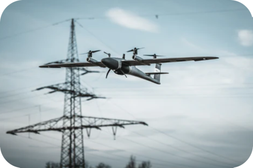
Qube 640
Mapping Drone
eVTOL Fixed-wing Mapping Drone for Professionals

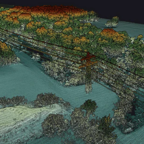
Not just limited to productivity gains, the Qube 640 sensor excels in precision and accuracy. Enhanced vegetation penetration reveals intricate details of foliage and trunks with unmatched clarity. Vertical scanning applications are effortlessly facilitated, thanks to the new IMU which minimizes outer edge mismatches, ensuring precise data collection every time.
Furthermore, the integration of an 8MP RGB camera allows for simultaneous LiDAR capture and colorization during flight, streamlining data acquisition and enhancing the visual interpretation of your scans.
Flight Altitude
18 m/s
Flight Speed
18 m/s
Area
170 ha
Flight Time
42 min


Technical Specifications

Get a Quote
Please complete the form below to submit your quote request.
